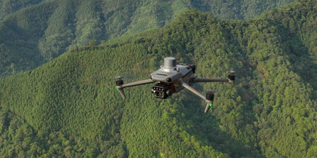


DJI has released a firmware update for the Mavic 3E and Mavic 3T adding a number of new features, optimising existing ones, and fixing a few bugs to improve the user experience.
Firmware information
What's new
The DJI Mavic 3 Enterprise series now has Terrain Follow capability for both real-time and DSM modes. This feature enables the Mavic 3 Multispectral to conduct Smart Oblique (DSM Follow only) and Linear missions while keeping a consistent distance to the terrain even when the terrain undergoes changes.
The Mavic 3M has a new Point of Interest function that permits it to orbit an object, recording comprehensive data from all angles. Additionally, the RGB camera has been upgraded with 8x digital zoom capability.
DJI has recently decreased the minimum altitude for Real-Time Follow mode, now enabling flights as low as 30 metres instead of the previous 80 metres, while maintaining the maximum altitude of 200 metres. This modification will enhance the quality of data collected nearer to the ground.
Mavic 3E and Mavic 3T now have support for encryption in Network Security Mode found in the DJI Pilot 2 app.
Other changes
- Added ability to customise the camera angle for mapping tasks. When planning a flight route, the aircraft orientation and gimbal pitch angle can be set for the route. This is highly convenient for inspections of specific scenarios, such as solar panels.
- Added ability to execute flight tasks during flight for fast and efficient execution of flight tasks at the current location. Tap the flight route icon to create or select a flight task on the camera or map view of the DJI Pilot 2 app.
- Added ability to set Safe Takeoff Altitude for flight tasks to improve flight safety. This parameter setting is only valid when the aircraft executes a flight task before takeoff. If the aircraft starts a flight task during flight, the safe takeoff altitude will not take effect.
- Added ability to create mapping or oblique tasks by selecting an area in the map view. This is convenient to generate a flight route after synchronising the mapping area planned on DJI FlightHub 2 to the DJI Pilot 2 app.
- Added ability to import MBTiles format maps downloaded from Maptiler. The map layer can be customised in the DJI Pilot 2 app.
- Added the ability to export logs by different modules in the DJI Pilot 2 app.
- Optimised firmware update prompt in the DJI Pilot 2 app.
- Fixed the issue of the aircraft returning too slowly if RTH is triggered from a short distance.
- Fixed the issue of the RTH altitude not updating timely on the DJI Pilot 2 app.
- Fixed the rare issue of the aircraft vibrating when the aircraft orientation is adjusted during manual flight.
- Added ability for Mavic 3T to adjust infrared temperature measurement parameters, such as subject emissivity and temperature measurement distance.