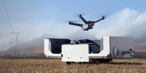
KlauGeomatics have created a plug and play PPK (post processed kinematic) camera positioning system that can be integrated with most cameras on most UAVs. A perfect addition to your drone to supply industry solutions for the task at hand. An adept tool for 3D modelling, agriculture and aerial inspection. We truly recommend this product if it relates to your industry needs.
Below are the main fields of work that use the PPK system:
-
3D Modelling
The PPK will assist in gaining highly accurate data needed for 3D modelling with only minimal GCPs.

-
Agriculture
You are able to create accurate 2D maps with out GCPs that are perfect for Precision Agriculture.

-
Aerial Inspection
The PPK is an accurate asset for inspections from above as you are able to build precise 3D City Models from oblique photography for asset inspection and management.

The UAV you use will operate as it normally does, alongside the existing autonomous GPS. The PPK system then logs the camera events with very precise carrier phase GNSS data to provide extremely accurate camera positions after post processing. With the base station data, after your flight you are able to process the logged data.
After the post processing you will gain high precision camera coordinates that you can use to input into your photogrammetry software with your images. Because the accuracy is on a centimetre level the mapping and modelling that is produced will have the absolute highest possible accuracy.
The system essentially produces high accuracy GNSS (GPS plus Glonass) camera positions to increase accuracy in photogrammetric mapping and reduce ground control requirements.
When it comes to PPKs, accuracy is extremely vital. KlauGeomatics system have achieved a crazy accuracy of 3cm with local base station.
It is compatible with DJI's X3 and X5 cameras as well as the Micasense RedEdge multispectral camera. It is also compatible with DJI's M100, M600 and M200 aircrafts.

The Matrice 600 supporting the Klau PPK

The Micasense RedEdge and Klau PPK
You can buy the Klau PPK System here.
For any further questions or queries, shoot us an email or give us a call and one of our team members will be in touch shortly.


